Loading a 3D Model
The 3D model feature allows you to place a pre-prepared 3D object at any point in the 3D terrain. These models can be created using external design tools. Models can be loaded in any of the following formats:
§ COLLADA (DAE), e.g., DAE models created in PhotoMesh or Sketchup
§ OBJ – Wavefront simple data-format for storing 3D model surface geometry, color and texture information.
§ Direct X (X) and its compressed version (XPC)
§ 3DS – 3D studio format for exchanging 3D data models
§ OpenFlight (FLT) – Multigen format for exchanging 3D data models and its compressed version (FPC)
§ XPL and XPL2, which provide better performance for the Direct X model (A set of XPL files is created from a single X file where each file contains data for one Level of Detail (LOD) only)
§ GLB – Binary file format representation of 3D mesh models saved in the GL Transmission Format (glTF).
All model formats support BMP, JPG, DDS, and PNG texture formats. FLT also supports Silicon Graphics popular texture formats (RGB, RGBA, INT, INTA, BW).
All loaded models can be optimized by conversion to XPL2, either by using the Convert Models to XPL tool or automatically during the publishing process.
Note: Model files are automatically converted to XPL2 during the loading process if the option is selected in Project Settings. See “General” in the “Setting the Project” chapter.
When a model file is converted to XPL, a set of XPL files is created from a single X file where each file contains data for one Level of Detail (LOD) only. TerraExplorer displays the best LOD file based on the viewer position in relation to the object. When downloaded from a web server, each file is also downloaded independently. This results in an improvement in overall model display performance as well as download rate.
Note: Generating Level of Detail is recommended for projects that have dense model layers, with non-optimized models (e.g., KML with DAE models). Although objects may take slightly longer to load the first time, memory usage will be optimized.
Note: XPL files were created by earlier versions of TerraExplorer Pro. Newer versions create only XPL2 files.
Note: The following limitations apply when loading 3DS files:
· When 3DS animation files are loaded, only the first frame is read.
· The alpha must be in the diffuse map and not in the mask map.
Note: The following limitations apply when loading OpenFlight (FLT) files:
· Only the best LOD is used.
· Animation is not supported.
· External referencing is not supported (One FLT file cannot link to another one).
Loading a New 3D Model
To load a new 3D model:
1. On the Objects tab, in the 3D Objects group, click 3D Model. The Browse for 3D Model dialog is displayed.
2. Browse to the required file to load, and click Open. The 3D model is displayed in the 3D Window and the Static 3D Model Property sheet is displayed.
3. If you want to add the 3D model based on where the mouse is pointing in the 3D Window, on the top bar of the label’s property sheet, click Set Position Based on Mouse ![]() . See “Moving an Object Based on Where the Mouse is Pointing in the 3D Window” in the “Working with Objects” chapter for more information.
. See “Moving an Object Based on Where the Mouse is Pointing in the 3D Window” in the “Working with Objects” chapter for more information.
4. If you want to add the 3D model based on where the mouse is pointing in the 3D Window and snap it to another object, on the top bar of the 3D model’s property sheet, click Snap Based on Snapping Options ![]() . See “Moving an Object Based on Where the Mouse is Pointing in the 3D Window” and "Setting Snapping Options" in the “Working with Objects” chapter for more information.
. See “Moving an Object Based on Where the Mouse is Pointing in the 3D Window” and "Setting Snapping Options" in the “Working with Objects” chapter for more information.
5. If you want to add the 3D model in the XY plane, on the top bar of the object’s property sheet, click XY Plane ![]() . See “Moving an Object in the XY Plane”
. See “Moving an Object in the XY Plane”
6. With the cursor in the 3D Window, click the mouse to define the position of the 3D model’s pivot point on the terrain.
Note: The pivot point of a 3D model is set at the 0, 0, 0 point in the object’s coordinate system. It is recommended to create the object with the pivot point located at the center of the bottom surface of the object. To change an object’s pivot point, you should edit it with the original tool from which it was built.
7. You can adjust the model’s position and size in the 3D Window or from the model’s property sheet. See “Editing Objects in the 3D Window” in the “Working with Objects” chapter.
8. Using the property sheet, set the parameters of the 3D object. See “3D Model Property Sheet Parameters” in this chapter for information.
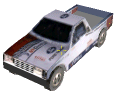
Example of a 3D Model Object
3D Model Property Sheet Parameters
|
Object Parameter |
Activity |
|
Appearance |
|
|
Name |
Type the description or name of the 3D model. This text appears in the Project Tree as the name of the object. |
|
Activation Action |
Select the action to perform when selecting the 3D model from the Project Tree. |
|
Shadow |
When set to Yes, a shadow is cast on the 3D model. The sun is positioned according to the time, date and time zone you set using the Date and Time controls. The shadow dynamically updates when the system date and time is changed. |
|
Model |
|
|
File Name |
Type or browse a path to an .x, .xpc, .flt, .fpc, .3ds or .dae file to load as the 3D model. |
|
Model Type |
Select Animation to play the object animation or Still to stop object animation at the first frame. This option is enabled only for Direct X animation models that comply with the DirectX specification. |
|
Animation Speed Rate |
Selects the animation speed rate. |
|
Position |
|
|
Altitude Method |
Sets the altitude method to be used by the 3D model: § Select Relative to Terrain to place the 3D model’s pivot point at a specified altitude above the ground. § Select Absolute to place the 3D model’s pivot point at a specified altitude above the terrain database vertical datum base ellipsoid. |
|
Altitude |
Enter the altitude, as defined in Altitude Method, for the 3D model’s pivot point. If the model has a Z value, this value is added to each Z-coordinate. |
|
X |
Enter the X-coordinate for the 3D model’s pivot point. |
|
Y |
Enter the Y-coordinate for the 3D model’s pivot point. |
|
MGRS |
The coordinates of the 3D model’s pivot point in Military Grid Reference System (MGRS) coordinates. This field is only available if Show MGRS Coordinates was selected in the Options dialog. See “View” in the “Using TerraExplorer Options” chapter for more information. |
|
Yaw |
Determines the direction angle of the 3D model along the vertical axis relative to north. |
|
Pitch |
Determines the tilt angle of the 3D model along its lateral axis relative to the horizon. |
|
Roll |
Determines the roll angle of the 3D model along its longitudinal (front-to-back) axis. |
|
Geometry |
|
|
Maintain Aspect Ratio |
Maintain the model’s proportional relationship between the width, length, and height. If Yes is selected, when the scale factor in one of the axis is modified, the scale factor in the other two axes is automatically adjusted to maintain the original width:length:height ratio. If No is selected, the scale factor in each axis can be modified independently of the other axis scale factors. |
|
Scale X |
Determines the length on the X axis of the 3D model. The actual X value of the model in the 3D World is the x value of the model in its internal coordinate system times the Scale X value. (i.e., if the model has an X value of 5 units and the Scale X is set to 10 meters per pixel, the X value of the object in the 3D World is 50 meters.) |
|
Scale Y |
Determines the length on the Y axis of the 3D model. The actual Y value of the model in the 3D World is the Y value of the model in its internal coordinate system times the Scale Y value. (i.e., if the model has a Y value of 10 units and the Scale Y is set to 10 meters per pixel, the Y value of the object in the 3D World is 100 meters.) |
|
Scale Z |
Determines the height (Z value) of the 3D model. The actual height of the model in the 3D World is the height of the model in its internal coordinate system times the Scale Z value. (i.e., if the model has a height of 5 units and the Scale Z is set to 10 meters per pixel, the height of the object in the 3D World is 50 meters.) |
|
Best LOD Size |
Enter the minimum size of the object, in pixels, at which the object is displayed in the best level of detail. When zooming out from the best LOD size the object is displayed using data retrieved from a lower Level of Detail file. For more information, see “Loading a New 3D Model” in this chapter. This size can be set automatically by clicking the Capture button in the Set Best LOD field. |
|
Set Best LOD |
Clicking the Capture button sets the current object size as the size where the best level of detail is used. When the object is zoomed out from the best-fit size, it is displayed using data retrieved from a lower Level of Detail file. |
|
Timespan |
|
|
Start Time |
Click Edit and select the date and time when the model should first become visible. |
|
End Time |
Click Edit and select the date and time when the model should stop being visible. |
|
Visibility |
|
|
Default Viewing Distance |
Determines the viewing distance of the camera from the 3D model. This distance is used as a stop mark for any “Fly-to” or “View Object” operation. It is also used when selecting to edit the object from the Project Tree. When this value is set to the default of -1, TerraExplorer calculates and sets the ideal viewing distance for the 3D model based on its size. |
|
Max. Visibility Distance |
Sets the maximal distance from the camera above which the model disappears. |
|
Min. Visibility Distance |
Sets the minimal distance from the camera below which the model disappears. |
|
General |
|
|
Show in Viewer |
Determines if the 3D model appears in the 3D Window when the file is viewed with the TerraExplorer Basic Viewer. |
|
Message |
The message associated with the object. The number displayed is the number of the message. To create a new message, or update an existing message, open the Create Message dialog by clicking in this field and selecting Edit. See “Using the Create Message Dialog” in the “Working with Objects” chapter for more information. |
|
Tooltip |
Type a tooltip text to appear when the mouse cursor is placed over the 3D model in the 3D Window. |
|
Ground Object |
Determines if the object is calculated as part of the terrain’s elevation. |