Loading a Point Cloud Model from File
To load a point cloud model from file:
1. On the Layers tab, in the Point Cloud group, click the arrow next to Point Cloud, and select CPT from file. The Browse for Point Cloud Model dialog is displayed.
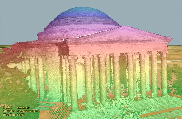
2. Browse to the required .cpt file to load as the point cloud model. The point cloud model is displayed in the 3D Window and its property sheet is opened.
3. If the point cloud model is geo-referenced, it is located accordingly on the terrain. Otherwise, it is placed at the center of the 3D Window. You can then manually edit its position, or reproject it. With the cursor in the 3D Window, click the mouse to define the position of the point cloud model’s center point on the terrain.
Note: The center point of a point cloud model is automatically calculated as the center of the bounding box holding all the points in the file.
4. Using the property sheet, set the parameters of the point cloud object. See “Setting and Editing Point Cloud Properties” in this chapter for information.

Example of a Point Cloud Model Object