
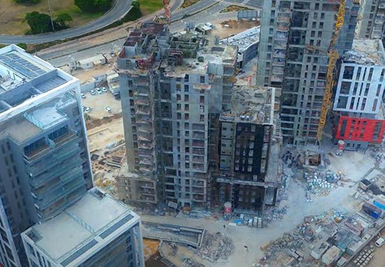


Convert images into highly-detailed 3D meshes with advanced color balancing & texturing. High-performance photogrammetry and computer vision algorithms efficiently handle large projects using advanced tiling mechanisms. Results are exportable in multiple formats for full GIS interoperability.
Produce highly accurate aerotriangulation for both close-range and large-scale projects, with multiple calculation modes for varying levels of GPS accuracy. Enhance precision with ground control points and an iterative build process that optimizes results.
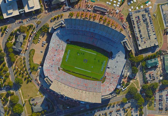
Convert images into high-resolution, multi-band orthophotos with exceptional detail & accuracy. With features like color balancing, edge and surface enhancement, and high-quality texturing, your orthophotos are both visually compelling and data-rich.
Share the workload of massive 3D database creation between several computers and processors on your local network. The master computer utilizes networked client computers to create terrain and generate optimized imagery and elevation formats for the server-side, on-the-fly terrain generator.
Cloud-based, fully automated services for high-quality 2D, 3D, and multi-spectral outputs. Generate 3D mesh, orthophotos, elevation models, and dense point clouds, all compatible with standard GIS tools. Input data and results are managed via your preferred cloud storage.
Seamlessly fuse terrain, raster and feature layers, 3D urban models, point clouds, & 2D/3D objects into a high-resolution 3D environment. Advanced tools convert models into Skyline’s optimized format, improving display performance.
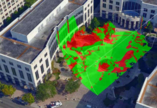
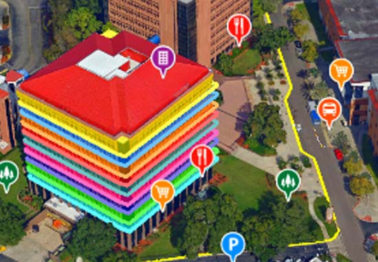
Robust suite of tools for extracting insights from geospatial data. Features terrain analysis tools like line-of-sight, and slope and contour maps, as well as distance and area measurement tools. Advanced options include terrain profile, volume analysis, & shadow query.
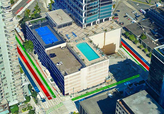
Powerful spatial operations such as merging, clipping, and exporting of features, support precise 3D data refinement. Versatile drawing tools enhance 3D GIS visualizations with roads, traffic lights, powerlines, & more while an advanced particle system simulates weather, lighting, water, smoke, & fire effects.
Powerful API to develop powerful, customized 3D desktop, Web, and mobile applications or integrate TerraExplorer capabilities in OEM applications. All the COM-based interfaces can be managed through scripting languages (e.g., JavaScript) as well as non-scripting languages (e.g., C++ or C#).
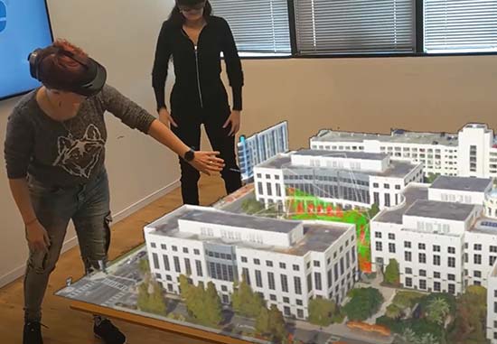
Explore, analyze, and edit high-resolution, stunningly realistic 3D content right in your web browser — no download required. Designed to meet diverse needs, TerraExplorer Fusion offers customization options and comes in two versions: Viewer and the advanced Plus version.
Extensive plugin support for loading data in any format, combined with professional tools for manipulating and merging all your imagery and elevation layers, make it easy to create photo-realistic, geographically accurate terrain databases. Option available for dynamic layer/project updates.
Full suite of web services for publishing, storing, managing, and streaming all your 2D and 3D geospatial content: 3D mesh, imagery, elevation, features, and point clouds. Convert and share your data in multiple formats for seamless collaboration with clients like Esri, QGIS, Cesium, and more.
| Cookie | Duration | Description |
|---|---|---|
| cookielawinfo-checkbox-analytics | 11 months | This cookie is set by GDPR Cookie Consent plugin. The cookie is used to store the user consent for the cookies in the category "Analytics". |
| cookielawinfo-checkbox-functional | 11 months | The cookie is set by GDPR cookie consent to record the user consent for the cookies in the category "Functional". |
| cookielawinfo-checkbox-necessary | 11 months | This cookie is set by GDPR Cookie Consent plugin. The cookies is used to store the user consent for the cookies in the category "Necessary". |
| cookielawinfo-checkbox-others | 11 months | This cookie is set by GDPR Cookie Consent plugin. The cookie is used to store the user consent for the cookies in the category "Other. |
| cookielawinfo-checkbox-performance | 11 months | This cookie is set by GDPR Cookie Consent plugin. The cookie is used to store the user consent for the cookies in the category "Performance". |
| viewed_cookie_policy | 11 months | The cookie is set by the GDPR Cookie Consent plugin and is used to store whether or not user has consented to the use of cookies. It does not store any personal data. |
For security purposes, please solve this simple puzzle to verify you are human before sending an OTP.