TerraExplorer for Web has many features that extend the capabilities of Cesium without requiring you to modify your existing code. In this post we go over some of the main features and benefits of TE4W and how they can help you leverage your Cesium environment.
Skyline offers a lightweight online 3D GIS viewer – TerraExplorer for Web – that enables you to view and analyze high-resolution, stunningly realistic SkylineGlobe 3D content in a web browser, without any plug-ins. TerraExplorer for Web seamlessly accesses online data from Skyline’s SkylineGlobe Server. All your geospatial data – terrain, feature, raster, mesh, and more – is easily published directly to SGS through a single publishing operation from TerraExplorer.
Building on standard Cesium support for imagery, elevation and KML layers, TerraExplorer for Web can also display most of your spatial databases including 3D city layers and feature layers. TerraExplorer for Web integrates smoothly with the entire Skyline product line for easy access to all your data – from photo-realistic, geographically accurate terrain databases created in TerraBuilder to PhotoMesh’s high-resolution, textured, 3D mesh models.
Based on HTML5/WebGL standards, TerraExplorer for Web provides support for multiple platforms and browsers (Windows, Mac, Linux, and selected mobile devices, Chrome, Edge, Firefox, and more).

TE4W Capabilities
- Lightweight Online Viewer – Based on the HTML/WebGL standard, TerraExplorer for Web 3D GIS viewer requires no plugin or application installation.
- Multi-Platform, Multi-Browser – TerraExplorer for Web provides support for multiple platforms (Windows, Mac, Linux and selected mobile devices) and multiple web browsers (Chrome, Edge, Firefox and others).
- Explore Data – Explore data from SkylineGlobe server as well as user-loaded content: terrain, GIS feature layers, imagery and elevation raster layers, and urban model layers. Data is seamlessly fused for a photo-realistic visualization.
- Measure and Analyze – Easily access distance and area measurement tools and graphic terrain profile for an enhanced understanding of the 3D environment.
- Data Query – TerraExplorer for Web offers address and point of interest search capability plus reverse search to enable you to quickly find and display the 3D environment information you require.
- Optimized Performance – Fast loading times and smooth navigation.
Advantages of Using TerraExplorer for Web with Cesium
Expanded Development Library
TerraExplorer for Web’s development kit extends the Cesium library with additional interfaces that enable you to take advantage of our many advanced capabilities without modifying your existing code. To use TE4W’s development kit, simply replace your Cesium “include” statement with the TE4W “include” line. All standard Cesium interfaces will now be available alongside the new, powerful, TerraExplorer interfaces.

Ready to Use and Customizable GUI
TerraExplorer for Web provides a flexible and powerful user interface that can be used as-is or customized using standard HTML (CSS) style file. The provided user interface saves developers valuable time and resources and enables even non-developers to provide Cesium-based solutions to their users.
Powerful Project Editor
In contrast to the standard Cesium library, Skyline’s TerraExplorer Pro (TEP) desktop application provides the means to easily create a customized TerraExplorer for Web page, even without any software development background. From TEP, you can create a complex project that includes all your geospatial data – terrain, feature, raster, mesh, and more, and then directly publish it to SkylineGlobe Server to use as a customized TerraExplorer for Web page.
Mobile App
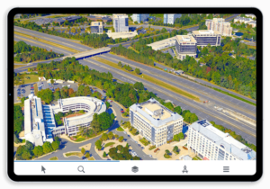
TE4W is optimized for most mobile devices. Special customizations and optimizations to the core library and the user interface, with a simple but efficient Android/iOS App interface that enables you to share your 3D web application with a larger audience.
Advanced Analysis Tools
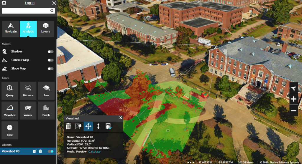
TerraExplorer for Web provides an advanced set of powerful measurement and analysis tools not found in your standard Cesium library, which increase understanding and improve decision making:
- Distance measurement –- Measure aerial/horizontal distance, elevation difference, slope, and ground distance.
- Area measurement – Range of options for measuring area: on terrain, on arbitrary plane, surface area, etc.
- Viewshed – Calculate and mark all areas on the terrain and on 3D models and objects that are visible from a selected point on the terrain. Both Preview and Hi-quality modes are available.
- Volume analysis – Analyze the volume of the terrain or model removed or added by drawn horizontal planes.
- Contour map – Create a topographic map on the entire terrain and 3DML layers that portrays differences in terrain elevation by coloring terrain according to varying altitudes and by connecting points of equal elevation with contour lines.
- Slope map – Apply semi-transparent palette colors to the entire 3D World according to slope degree. Slope map colors are rendered on terrain textures as well as on 3D models.
Advanced Terrain and 3D Model Modification Tools
TerraExplorer for Web expands basic Cesium capabilities with a set of terrain and 3D Tiles modification tools (modify terrain and hole on terrain) that enable you to integrate CAD/BIM models into an existing city-wide 3D mesh layer by flattening 3D mesh layers in a polygonal area, and then inserting the models in their correct positions. Modify Terrain objects can be created in TerraExplorer Pro and then published to SGS or created via the TE4W API.
Video on Terrain
TE4W supports the playing of a video stream either on a selected area of the terrain or on a floating billboard video on terrain and telemetry positioning information files. Video on terrain/billboard objects can be created in TerraExplorer Pro and then published to SGS or created via the TE4W API.

Underground Mode
TerraExplorer for Web includes a wide range of navigation options including mouse, keyboard, and on-screen navigation controls, favorite locations, and underground navigation.
Presentation Tool
TE4W enables you to easily share your 3D visualizations using advanced presentations recorded in your published TEP project, in which you navigate through the 3D World, showing or hiding objects on the terrain, following dynamic objects, displaying messages and performing different operations.
Server-Side Capabilities (SGS)
- Publish all your geospatial data to SkylineGlobe Server through a single publishing operation from TerraExplorer Pro.
- Serves TE4W/Cesium/TED and other applications. On-the-fly conversion between formats to minimize storage size.
- All data on your server is cataloged and referenced so clients can easily find the specific published layer required.
- Your data is kept safe by multiple security layers, including restriction of each user group to predefined data folders and a robust user authentication mechanism.
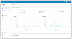
- SkylineGlobe Server supports the hosting of multiple virtual servers (“sites”) on a single server. Each site is distinct and separate, with its own data sources, layers, groups/users, settings, aliases, TE4W configurations, statistics, site administrator, etc.
Compatibility with TerraExplorer Desktop
All TE4W projects can be viewed and edited in Skyline’s TerraExplorer Desktop application, as well as in TE4W and Cesium viewer. The same project can be opened in multiple different applications simultaneously.
Feature Layer Streaming and Styling
TerraExplorer for Web supports the loading of styled feature layers from standard WFS services. WFS/WFS-T Layers can be loaded into TerraExplorer Pro and styled based on their attribute information and then directly published to SkylineGlobe Server for loading into TerraExplorer for Web projects.
3D Tiles Ground Surface
3D tiles are loaded into TE4W embedded with ground surface information, thus enabling seamless integration of 3D cities in your terrain database, as well as drawing of ground level feature layers on the 3D model ground surface.

Take advantage of these features today. Click the link below to experience TE4W now:

