PhotoMesh Drone - High Performance 3D Modeling for Drone Imagery
PhotoMesh converts drone data into detailed 2D/3D outputs with advanced photogrammetry
Drone Data to Detailed 3D Models
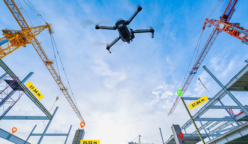
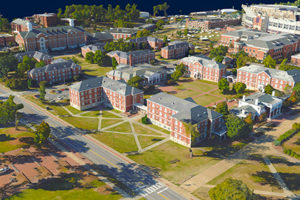
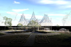
PhotoMesh Drone converts drone-captured photos, including multi-spectral bands, video, and LiDAR from a variety of sensors into highly-detailed 2D and 3D outputs. Built on high-performance photogrammetry, computer vision, and AI algorithms, PhotoMesh excels at the most challenging mapping and close-range reconstruction projects. PhotoMesh produces outputs in industry-standard formats, including multi-resolution 3D mesh models (3DML, 3D Tiles, SLPK, DAE, OBJ, …), rasters (Orthophoto/True Orthophoto, DSM, DTM), and point clouds (LAS/LAZ), ensuring seamless interoperability with other 2D and 3D GIS solutions.
Optimized Local Hardware Performance
Designed as a powerful, single-computer solution, PhotoMesh Drone fully utilizes local hardware capabilities to deliver fast and accurate photogrammetry and 3D modeling for your projects.
- 3D Mapping
- Digital Twin
- 2D Mapping
Transform aerial and ground photos and Lidar collections into city-scale, digital twin models with advanced color balancing and high-quality texturing, in a range of 3D mesh and point cloud formats. With its survey-grade, geo-referencing accuracy, PhotoMesh Drone can be used for urban planning, infrastructure and engineering project management, inspection and 3D GIS applications.
PhotoMesh Drone supports close-range photogrammetry, producing point cloud and mesh models with sub-millimeter accuracy. These models can be leveraged to perform virtual industrial inspection and asset management that remove the risk of human error, at a fraction of the time and cost of on-site, traditional inspection methods. PhotoMesh’s range of 3D outputs can also be enablers of customized AI and machine learning analysis tools.
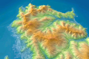
Fully automated, high quality generation of multispectral true-orthophotos, Digital Surface Models (DSM) and Digital Terrain Models (DTM). PhotoMesh 2D mapping outputs can be used in a broad range of industries, including agriculture and urban mapping, as well as serve as enablers of customized AI-powered analysis tools.
Data captured by 𝗣𝗵𝗮𝘀𝗲 𝗢𝗻𝗲 𝗣𝟯, 𝗲𝗾𝘂𝗶𝗽𝗽𝗲𝗱 𝘄𝗶𝘁𝗵 𝘁𝗵𝗲 𝗶𝗫𝗠-𝗚𝗦𝟭𝟮𝟬
Highest Quality Outputs
PhotoMesh Drone generates the highest quality 3D and 2D outputs in the industry. PhotoMesh excels at reconstruction of man-made surfaces including buildings, infrastructure, and roads. It performs high-quality True Ortho and Rapid Ortho Composite of exceptional quality and accuracy.
Precise Geo-Positioning
PhotoMesh Drone leverages GPS/RTK/PPK geo-positioning data for aerotriangulation, enhancing model positioning with manual or automatic control points. Alternatively, PhotoMesh can automatically register to a reference project to pixel-level precision – ideal for repeat projects or projects in GPS-denied environments.
LiDAR Integration
PhotoMesh Drone performs hybrid photogrammetric processing of images with LiDAR to create higher quality output than possible with either photogrammetry or LiDAR alone.
Multispectral Processing
PhotoMesh Drone integrates multispectral bands, such as NDVI and GRVI, to enrich mesh texturing and orthophoto generation, enabling more detailed analysis of surface characteristics for a variety of applications.
Geospatial Visualization
PhotoMesh Drone is bundled with TerraExplorer for large-scale visualization of outputs with 3rd-party geospatial data including GIS, imagery, LiDAR, and DEM.
Quality Reports
PhotoMesh Drone delivers comprehensive Quality Reports to optimize quality and prove the accuracy of our outputs.
Powerful Simplicity
PhotoMesh Drone provides powerful tools for analysis and visualization, enabling efficient preview, refinement, and data optimization—all within an intuitive interface enhanced by step-by-step guided wizards that simplify complex workflows.
PhotoMesh Drone makes it easy to combine data of a variety of formats and sources
- Standard image formats (Jpg, Tiff…)
- Photos with hyperspectral bands (NIR)
- Phase One IIQ
- AT packages - Bingo, Inpho, VisionMap, Stellacore…
- Video files (most formats)
- LIDAR (LAS, E57)
- Photo list files
Range of supported output formats ensures maximum interoperability with other 2D/3D GIS solutions
3D Mesh
Point Cloud
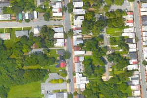
Orthophoto
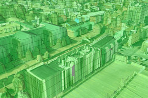
Digital Surface Model (DSM)
